Tongariro National Park (421)
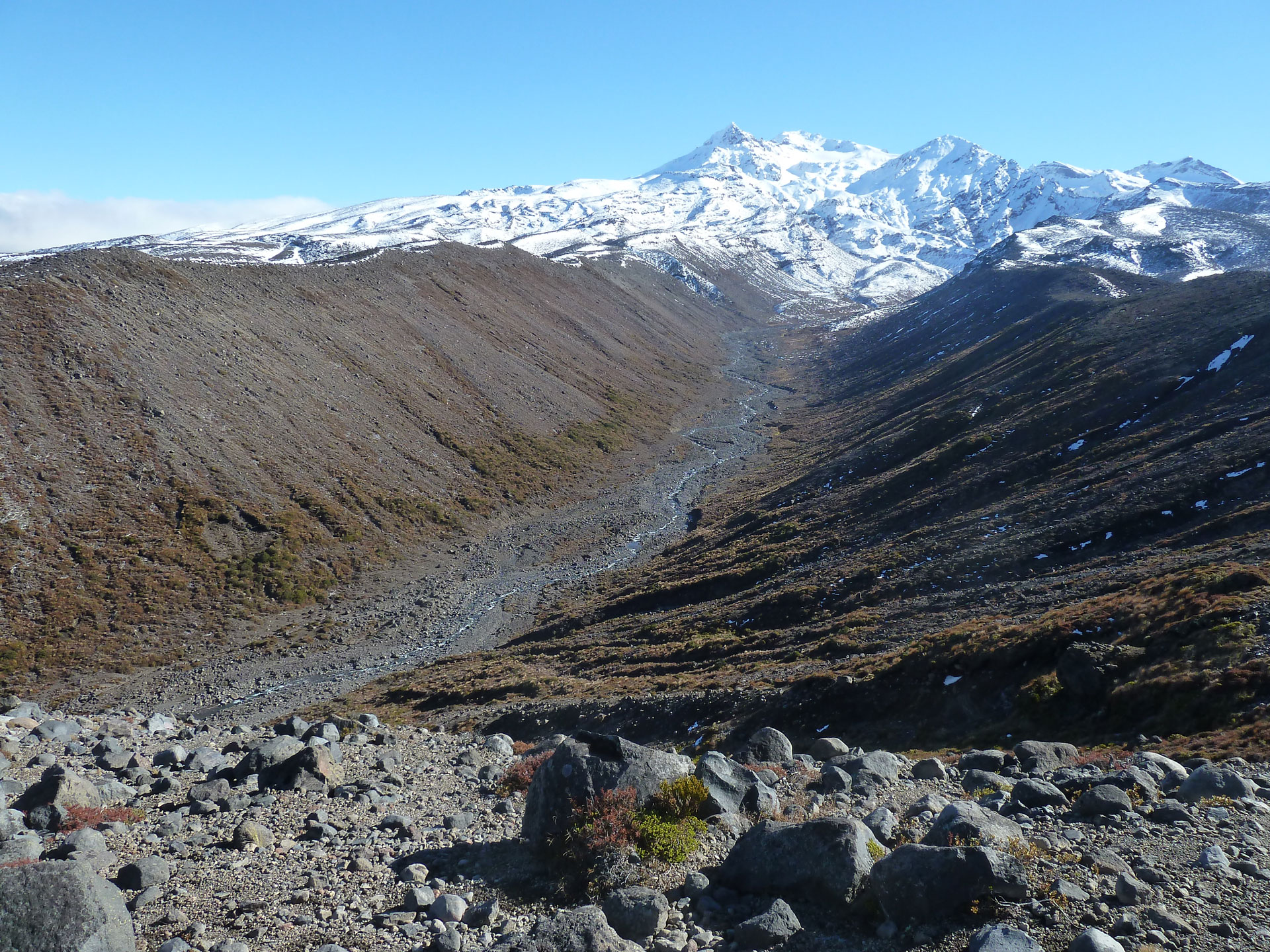
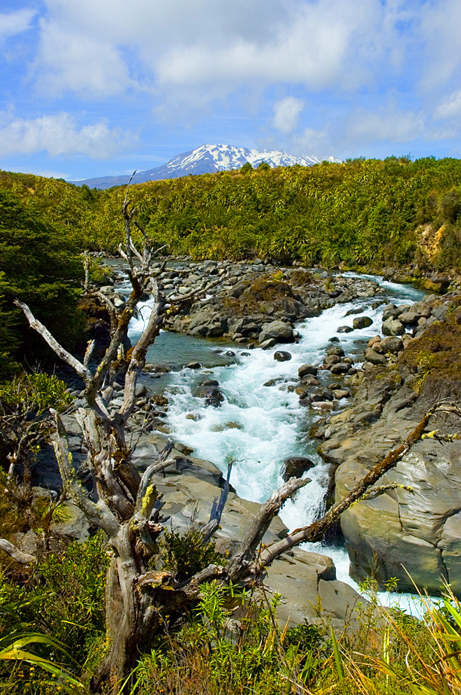
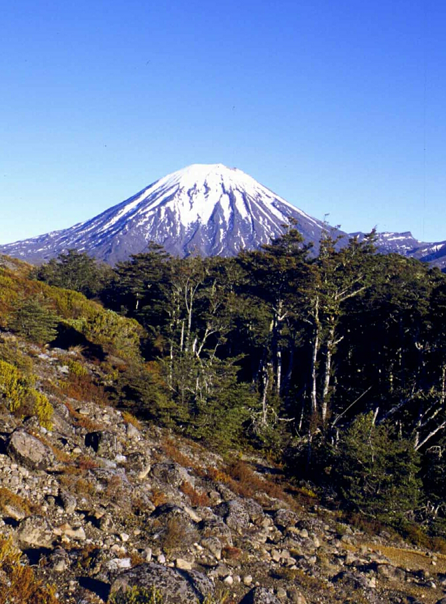
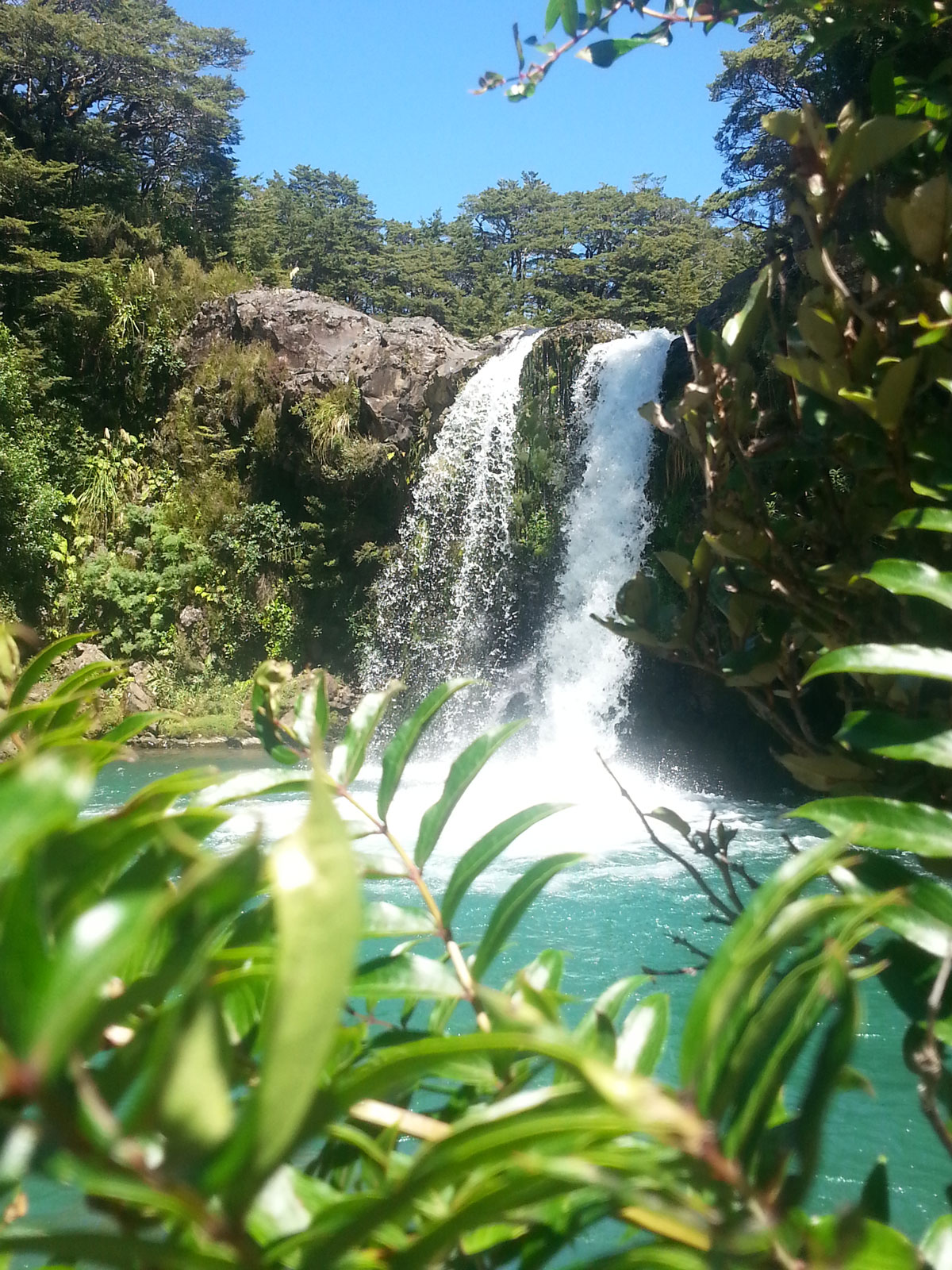
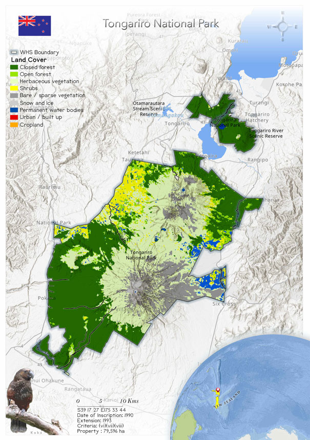
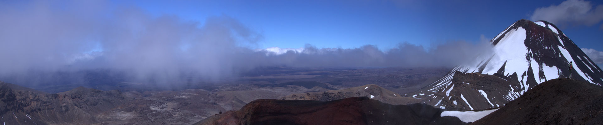
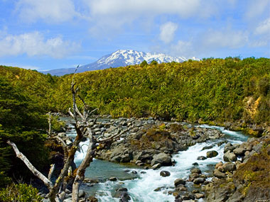 Lying between 38° 58 to 39° 35 S and 175°22 to 175° 48 E The Park encircles the Ruapehu-Ngauruhoe-Tongariro mountain massif and includes the Mount Pihanga - Mount Kakaramea range with LakeRotopounamu, to the northeast. It lies at the southern end of a discontinuous chain of volcanoes which extends north-east 2,500km into the Pacific Ocean, overlying the subduction zone of the Pacific Ocean plate beneath the Indian-Australian continental plate. The Park’s volcanoes are predominantly andesitic in composition, and fall into two groups. The northern group of Pihanga, Kakarameaand Tihia are volcanoes with associated vents, domes, cones and craters which extend 10km north-west to south-east and have not been active for between 20,000 and 230,000 years. Glacial activity 100,000-14,000 years ago rounded its profiles. The southern group is currently active and comprises the three great volcanoes of central North Island in a range which extends about20km by 10km wide along a south-west to north-east axis: Tongariro (1,968m), Ngauruhoe (2,290m) and Ruapehu (2,797m), which is the highest mountain onNorth Island. The Park contains other extinct volcanoes, laval and glacial deposits and springs. Marine mudstone and sandstone of Miocene-Pliocene origin form two hilly areas in the west.
 Lying between 38° 58' to 39° 35' S and 175°22’ to 175° 48' E The Park encircles the Ruapehu-Ngauruhoe-Tongariro mountain massif and includes theMount Pihanga - Mount Kakaramea range with LakeRotopounamu, to the northeast. It lies at the southern end of a discontinuous chain of volcanoes which extends north-east 2,500km into the Pacific Ocean, overlying the subduction zone of the Pacific Ocean plate beneath the Indian-Australian continental plate. The Park’s volcanoes are predominantly andesitic in composition, and fall into two groups. The northern group of Pihanga, Kakarameaand Tihia are volcanoes with associated vents, domes,cones and craters which extend 10km north-west to south-east and have not been active for between 20,000 and 230,000 years. Glacial activity 100,000-14,000 years ago rounded its profiles. The southern group is currently active and comprises the three great volcanoes of central North Island in a range which extends about20km by 10km wide along a south-west to north-east axis: Tongariro (1,968m), Ngauruhoe (2,290m) and Ruapehu (2,797m), which is the highest mountain onNorth Island. The Park contains other extinct volcanoes,laval and glacial deposits and springs. Marine mud stone and sandstone of Miocene-Pliocene origin form two hilly areas in the west.
The north-east to south-west orientation of the mountains results in most precipitation from the prevailing westerly winds falling on the windward side of the Park which causes semi-arid conditions in the rain-shadowed land to the east. The north and west has annual rainfall of 1,800-3,500mm, the south and east, only about 1,100mm per annum. Winter snow extends to about 1,500m. The 1931-1960 mean annual temperatures were between 9.6°C and 10.1°C at 600m and 7.1°Cat 1,100m. The absolute minimum and maximum temperatures recorded are -10°C and 25°C, respectively. Whakapapa has only 120 days of annual growing season.
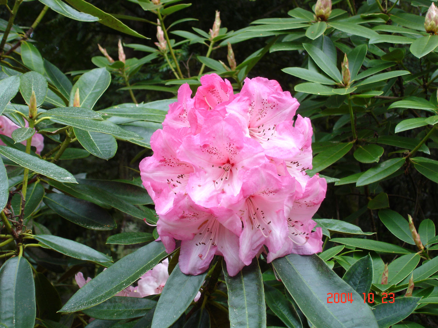
Dominant species include New Zealand red tussock grass Chionochloa rubra, Dracophyllum longifolium, D. recurvum, the sedge Empodisma minus, bogrush Schoenus pauciflorus, heather and the grasses Festuca novae zelandiae and Poa colensoi. Native mammals include the New Zealand lesser short-tailed and long-tailed bats Mystacina tuberculata (VU) and Chalinolobus tuberculatus (VU), but the native vertebrate faunais restricted mainly to birds. More than 56 bird species have been recorded in the Park including northern brown kiwi Apteryx mantelli (EN), blue duck Hymenolaimus malacorhynchus (EN), New Zealand falcon Falco novaeseelandiae, banded dotterel Charadriusbicinctus, kaka Nestor meridionalis (EN) and NorthIsland fern bird Bowdleria punctata vealeae (DLS, 1986;Johnson, 1976).
Lying between 38° 58' to 39° 35' S and 175°22’ to 175° 48' E The Park encircles the Ruapehu-Ngauruhoe-Tongariro mountain massif and includes theMount Pihanga - Mount Kakaramea range with LakeRotopounamu, to the northeast. It lies at the southern end of a discontinuous chain of volcanoes which extends north-east 2,500km into the Pacific Ocean, overlying the subduction zone of the Pacific Ocean plate beneath the Indian-Australian continental plate. The Park’s volcanoes are predominantly andesitic in composition, and fall into two groups. The northern group of Pihanga, Kakarameaand Tihia are volcanoes with associated vents, domes,cones and craters which extend 10km north-west to south-east and have not been active for between 20,000 and 230,000 years. Glacial activity 100,000-14,000 years ago rounded its profiles. The southern group is currently active and comprises the three great volcanoes of central North Island in a range which extends about20km by 10km wide along a south-west to north-east axis: Tongariro (1,968m), Ngauruhoe (2,290m) and Ruapehu (2,797m), which is the highest mountain onNorth Island. The Park contains other extinct volcanoes,laval and glacial deposits and springs. Marine mud stone and sandstone of Miocene-Pliocene origin form two hilly areas in the west.
The north-east to south-west orientation of the mountains results in most precipitation from the prevailing westerly winds falling on the windward side of the Park which causes semi-arid conditions in the rain-shadowed land to the east. The north and west has annual rainfall of 1,800-3,500mm, the south and east, only about 1,100mm per annum. Winter snow extends to about 1,500m. The 1931-1960 mean annual temperatures were between 9.6°C and 10.1°C at 600m and 7.1°Cat 1,100m. The absolute minimum and maximum temperatures recorded are -10°C and 25°C, respectively. Whakapapa has only 120 days of annual growing season.
Dominant species include New Zealand red tussock grass Chionochloa rubra, Dracophyllum longifolium, D. recurvum, the sedge Empodisma minus, bogrush Schoenus pauciflorus, heather and the grasses Festuca novae zelandiae and Poa colensoi. Native mammals include the New Zealand lesser short-tailed and long-tailed bats Mystacina tuberculata (VU) and Chalinolobus tuberculatus (VU), but the native vertebrate faunais restricted mainly to birds. More than 56 bird species have been recorded in the Park including northern brown kiwi Apteryx mantelli (EN), blue duck Hymenolaimus malacorhynchus (EN), New Zealand falcon Falco novaeseelandiae, banded dotterel Charadriusbicinctus, kaka Nestor meridionalis (EN) and NorthIsland fern bird Bowdleria punctata vealeae (DLS, 1986;Johnson, 1976).
As for 19 Natural and Mixed Properties inscribed for geological values before 1994, criteria numbering of this property has changed. In 1993 Tongariro became the first property to be inscribed on the World Heritage List under the revised criteria describing cultural landscapes. The mountains at the heart of the park have cultural and religious significance for the Maori people and symbolize the spiritual links between this community and its environment. The park has active and extinct volcanoes, a diverse range of ecosystems and some spectacular landscapes.
Criterion (vi)
The mountains that lie at the heart of the Tongariro National Park are of great cultural and religious significance to the Maori people and are potent symbols of the fundamental spiritual connections between this human community and its natural environment.
Criterion (vii)
Superlative natural phenomena and natural beauty. The main volcanic peaks are outstanding scenic features of the island.
Criterion (viii)
Earth's Evolutionary History. The park lies at the south-western terminus of a Pacific chain of volcanoes aligned along a major tectonic plate boundary. Ongoing geological processes. The park's volcanoes contain a complete range of volcanic features. The related ecological succession of plant communities is of special scientific interest.
Status
 The eruption of Mt. Ruapehu in 1995 and 1996 caused a large build-up of ash that blocked the outlet of Crater Lake. There is concern that when the Lakerefills (estimated to be sometime between late 2002 and 2005), a rapid collapse of the ash dam could occur followed by a major lahar (ash flow). Options to manage this risk and address issues of public safety need to take account of the protection of both the natural and the cultural values, as interference with the summit area and Crater Lake has implications for the protection of spiritual, traditional and cultural values to the Maori people. Following the request of the Committee at its 25th session (Helsinki, 2001) the State Party has provided a report following completion of a review of the management decisions taken to date to minimise the risks to safety associated with the impending RuapehuCrater Lake lahar.
The Minister of Conservation announced that the installation of a state of the art alarm and warning system, and the construction of a bank alongside theWhangaehu River are sufficient to address risks to public safety from an expected lahar.
In addition to these measures, the Department of Conservation is working closely with the Police and the Ministry of Civil Defence and Emergency Management to develop an appropriate emergency response plan. Furthermore, the Ministry is helping organisations with assets in the predicted lahar path to review the individual civil defence response plans.
Demonstrating an excellent example of cooperation between managers and staff of two of the globe’s most iconic World Heritage volcano sites, Hawaii VolcanoesNational Park in the USA and New Zealand’s TongariroNational Park worked together to assess risk to visitors in what can be inherently dangerous places.
The eruption of Mt. Ruapehu in 1995 and 1996 caused a large build-up of ash that blocked the outlet of Crater Lake. There is concern that when the Lakerefills (estimated to be sometime between late 2002 and 2005), a rapid collapse of the ash dam could occur followed by a major lahar (ash flow). Options to manage this risk and address issues of public safety need to take account of the protection of both the natural and the cultural values, as interference with the summit area and Crater Lake has implications for the protection of spiritual, traditional and cultural values to the Maori people. Following the request of the Committee at its 25th session (Helsinki, 2001) the State Party has provided a report following completion of a review of the management decisions taken to date to minimise the risks to safety associated with the impending RuapehuCrater Lake lahar.
The Minister of Conservation announced that the installation of a state of the art alarm and warning system, and the construction of a bank alongside theWhangaehu River are sufficient to address risks to public safety from an expected lahar.
In addition to these measures, the Department of Conservation is working closely with the Police and the Ministry of Civil Defence and Emergency Management to develop an appropriate emergency response plan. Furthermore, the Ministry is helping organisations with assets in the predicted lahar path to review the individual civil defence response plans.
Demonstrating an excellent example of cooperation between managers and staff of two of the globe’s most iconic World Heritage volcano sites, Hawaii VolcanoesNational Park in the USA and New Zealand’s TongariroNational Park worked together to assess risk to visitors in what can be inherently dangerous places.